


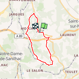

12,5 km | 15,8 km-effort


Gebruiker


Gratisgps-wandelapplicatie
 SityTrail
IGN / Geografische instituten
SityTrail World
De wereld gaat voor u open
Tocht Stappen van 12,4 km beschikbaar op Nieuw-Aquitanië, Dordogne, Boulazac Isle Manoire. Deze tocht wordt voorgesteld door YV24.
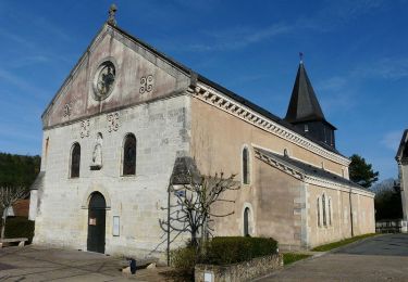
Boucle Aturienne selon n°17 PDIPR St Pierre de Chignac.
Attention, randonnée balisée préférentiellement pour un parcours dans le sens des aiguille d'une montre. Pas mal de bitume, peu d'ombre, un peu de petit relief. Praticable en tout temps

Stappen
Stappen
Stappen
Stappen
Stappen
Lopen
Stappen
Stappen

Te voet